China’s superior natural environment is reflected in multiple aspects, from climate to landforms and topography. It is among the few countries whose longitudinal span runs across the highest number of climate zones. From the northern part of Heilongjiang to the southern tip of Hainan, China has six climate zones: cold temperate, mid-temperate, warm temperate, subtropical, tropical and equatorial. That means all the climate zones, except the tundra and permafrost zones found near the poles, can be found in China. The mid-temperate, warm temperate and subtropical zones, which constitute and overwhelmingly large area of China’s territory, are especially ideal for human subsistence and development because of their moderate climate and four distinctive seasons.
China’s huge land area creates great regional differences in water conditions. Its average annual rainfall is 629mm (more then 6 trillion cubic meters). But its different regions are influenced differently by the summer monsoon and the times for its advance and retreat. They cause uneven spatial distribution of rain and gradual decrease of rainfall from the southeast to the northwest. The southern part, especially the southeastern coastal region, is highly influenced by the monsoon and enjoys and annual rainfall of 1,000mm or more. Huoshaoliao in northeastern Taiwan Province once experienced and annual rainfall of 8,408mm, a record in China.
Northwest China, which is part of the Eurasian plate, is less influenced by the monsoon. It has a low annual rainfall of less than 200mm, expect in some high mountains. The results: most areas in that part have turned into deserts or semi-deserts. For instance, Ruoqiang in Tarim Basin in Xinjiang, has reported an annual rainfall of less than 10mm for the past several years, and has thus become the driest place in China.
China’s climate is greatly influenced by the East Asian monsoon. In summer, the prevalence of southeasterly winds create hot and wet weather, raising the mercury higher than in other areas on the same latitude. The prevalence of northerly winds in winter result in cold and dry weather, and relatively low temperatures than in other areas on the same latitude. High temperatures in summer make most part of South China suitable for crops such as rice and cotton, and the accompanying wet weather makes them grow better.
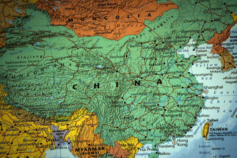
The country has diverse landforms, including large areas covered by mountains, plateaus, basins, plains and hills with different natural landscapes. China is a mountainous country, with 65 percent of its territorial land dominated by mountains, plateaus and hills. Many crisscrossing high and long mountain ranges constitute the framework of China’s landform.
Topographically, China’s western part is higher than its eastern part, creating a cascade-like slope from the west to the east. Its topography may thus be divided into three cascades: the first consists of areas east of the mountain chains, from Daxing’anling in the north to the Taihang, Wushan and Xuefeng mountain ranges. Most of the areas in this cascade are plains and hills less than 500m high. The country’s three plains, the Northeast China, North China and the Middle Lower Yangtze plains, as well as its largest hilly area in the southeast are all part of this casecade.
The second cascade comprises areas west of the three mountain chains, most of which are plateaus and basins between 1,000m to 2,000m above the sea level. Three of China’s four major plateaus-the Inner Mongolian Plateau, Loess Plateau and the Yunnan-Guizhou Plateau, as well as all its four major basins, Sichuan, Tarim, Junggar and Qaidam-are part of this cascade.
The third cascade is the Tibetan Plateau, which consists of stretches of flat plateaus above 4,000m and a series of long mountain ranges between 5,000m and 6,000m high. This plateau has more than ten 8,000m or higher peaks. The world’s highest peak, Mount Qomolangma, is on China’s border with Nepal and rises to 8844.43m, making the Tibetan Plateau the “Roof of the World”.
The natural inclining topography makes it easier for the humid ocean air to flow into China. Many rivers, shaped by and dependent on rainfall, not only connect the inland with coastal areas, but also provide huge water energy resources as they flow along the inclining topography with difference in water levels. Taking advantage of the topography, many hydropower stations have been built in the Yangtze and Yellow river valleys.